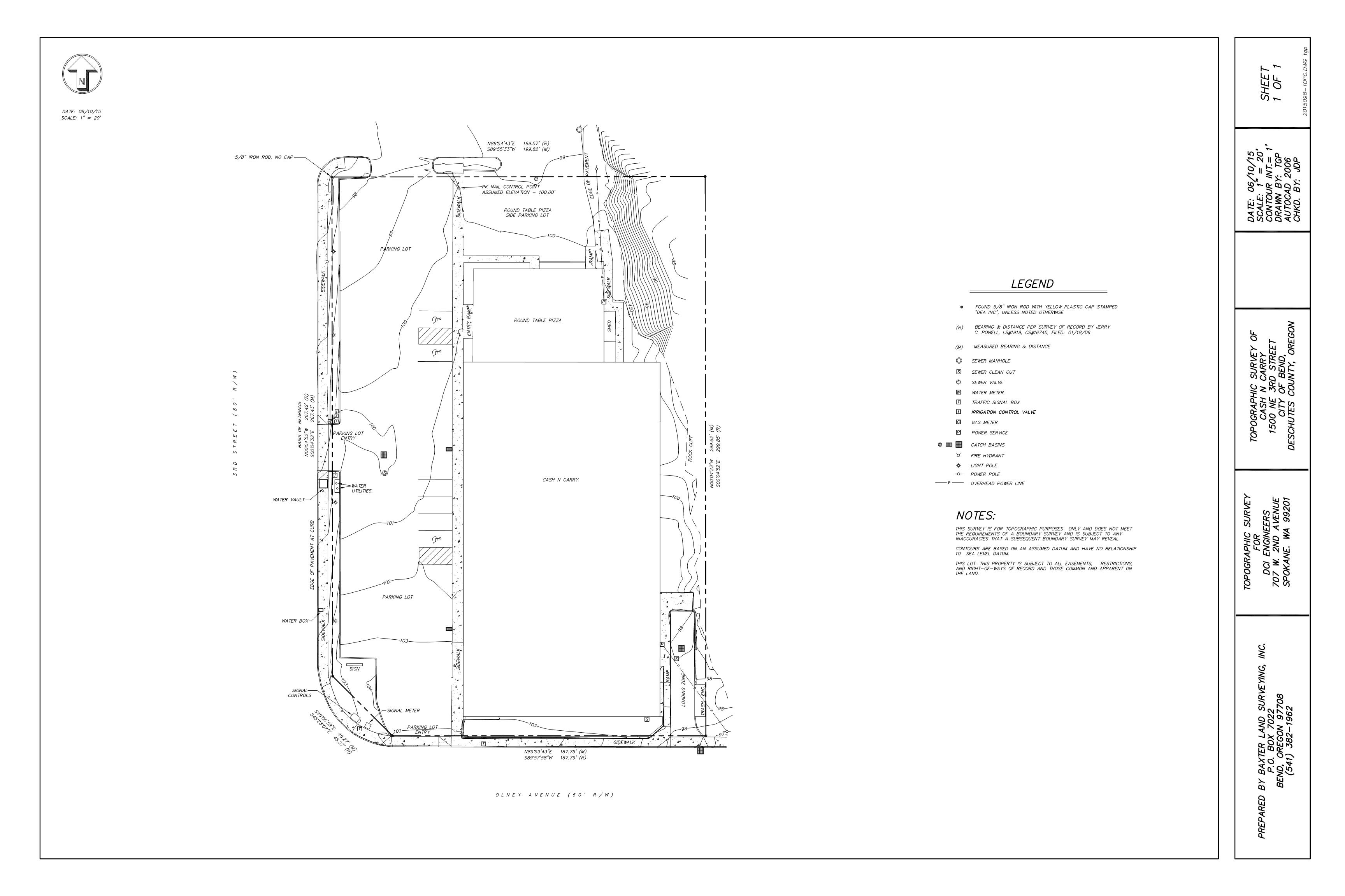
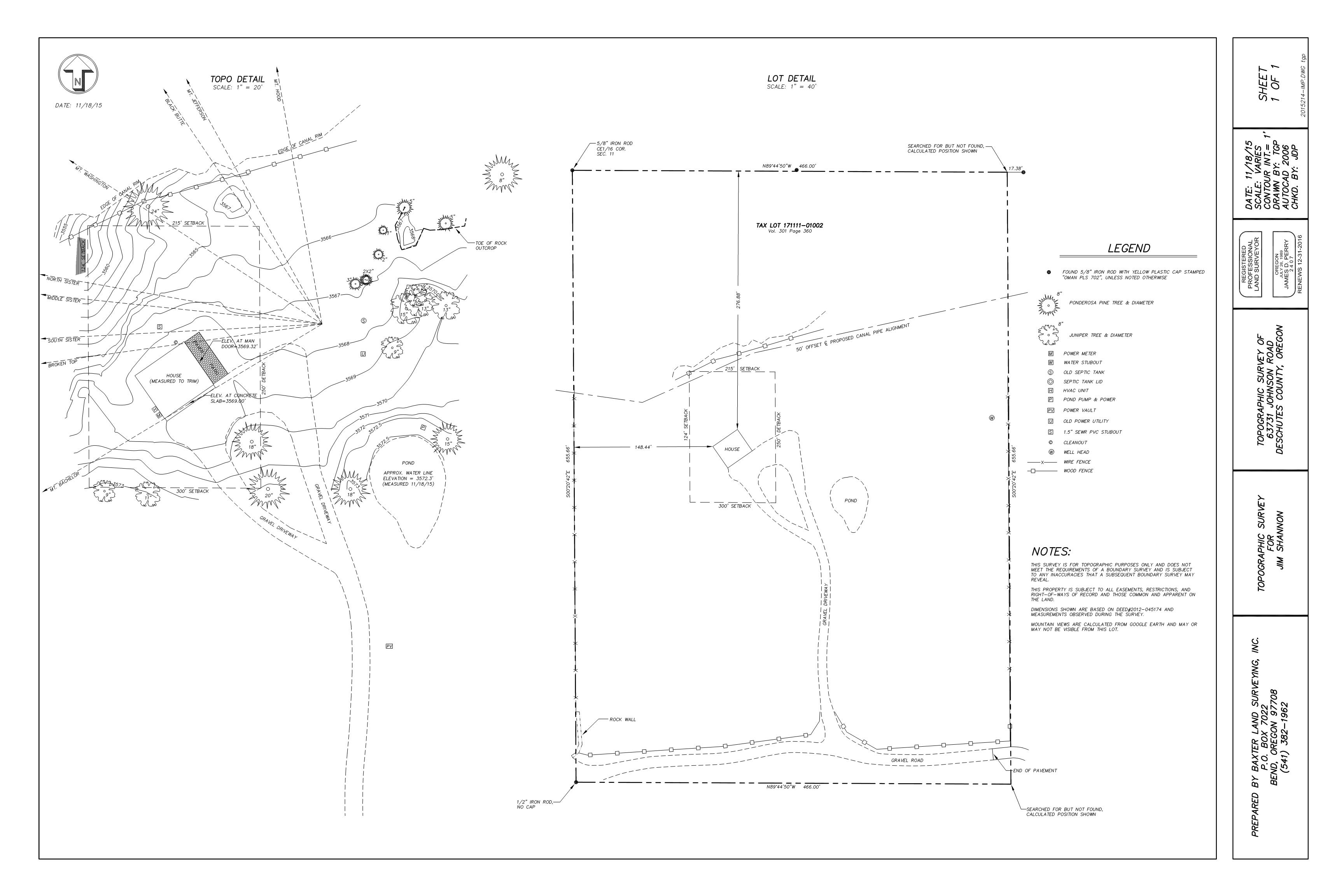
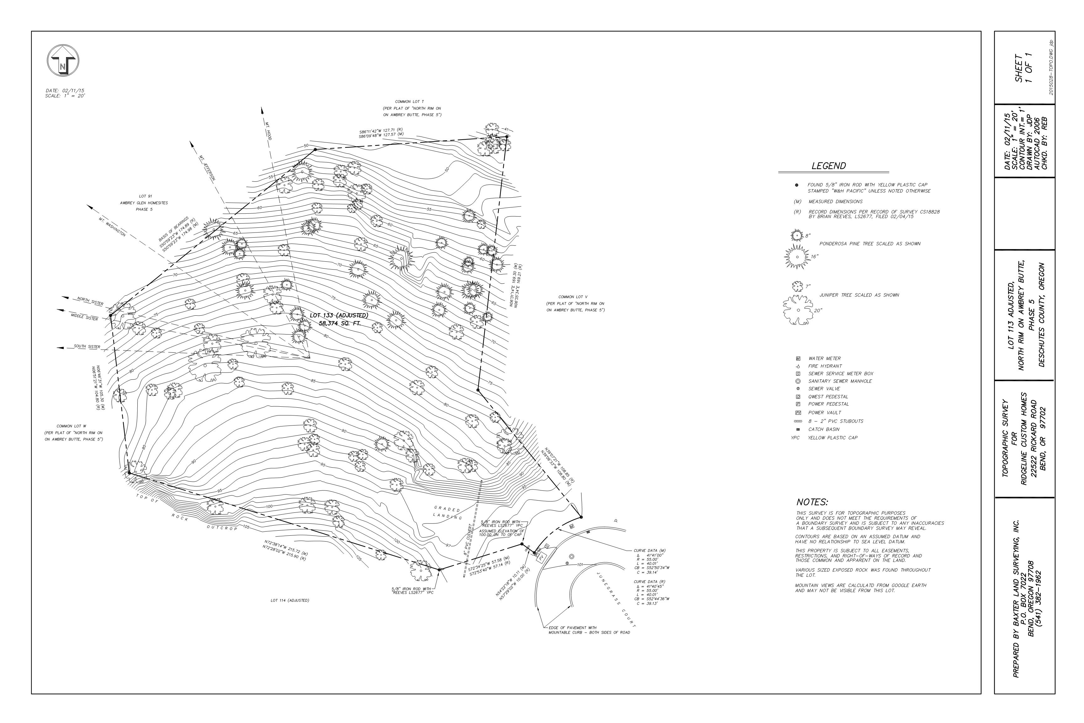
Topographic Surveys are used to identify and map the contours of the ground and existing features on the surface of the earth. Common features we include in our Topographic Surveys include 1' contours, trees, buildings, streets, walkways, utilities, mountain views, and any other features requested. We also show property boundary lines and the lines of easements on or crossing the property.
Below are Topographic Surveys done by Baxter Land Surveying